


Les Fours

ocepee
User
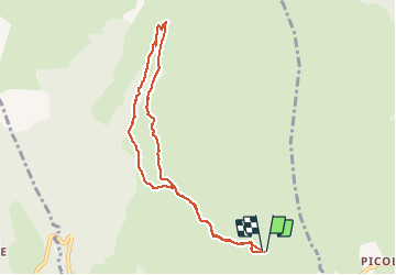

Length
8.4 km

Max alt
1637 m

Uphill gradient
256 m
Km-Effort
11.8 km

Min alt
1443 m

Downhill gradient
258 m
Boucle
Yes
Creation date :
2018-08-08 09:22:18.869
Updated on :
2018-08-08 12:26:13.926
2h25
Difficulty : Easy

FREE GPS app for hiking
 SityTrail
IGN / Geographical institutes
SityTrail Plus
The world is yours!
About
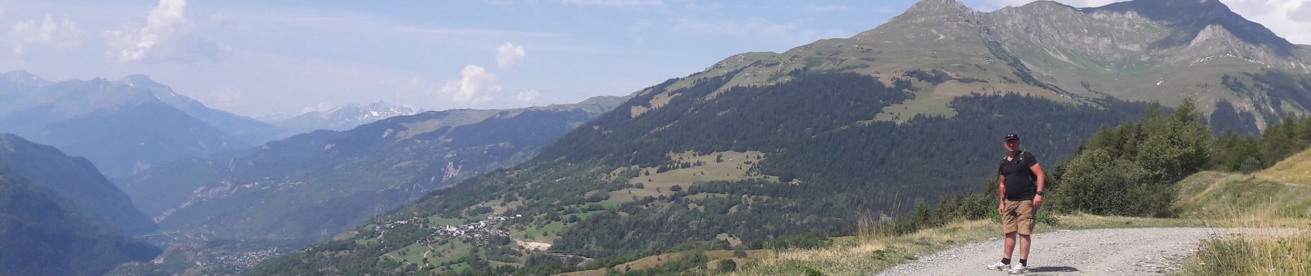
Trail Walking of 8.4 km to be discovered at Auvergne-Rhône-Alpes, Savoy, La Plagne-Tarentaise. This trail is proposed by ocepee.
Description
Super rando avec de beaux points de vue et divers paysages. Idéale à faire en famille.
Photos


Positioning
Country:
France
Region :
Auvergne-Rhône-Alpes
Department/Province :
Savoy
Municipality :
La Plagne-Tarentaise
Location:
Unknown
Start:(Dec)
Start:(UTM)
320070 ; 5050383 (32T) N.
Comments